Wisconsin’s Great River Road runs about 250 miles along Highway 35 from Prescott south to the Iowa border, through Driftless bluff country that was never touched by the glaciers and looks completely different from the rest of the state.
The Route at a Glance
Wisconsin’s Great River Road traces WI-35 along the east bank of the Mississippi River for about 250 miles, from Prescott in the north, where the St. Croix River joins the Mississippi near the Minnesota border, south to the Kieler area just above the Iowa border. Drive it end to end without stops and you’re looking at roughly four to four and a half hours. Give it two days with actual stops and it becomes one of the stronger road trips in the upper Midwest.
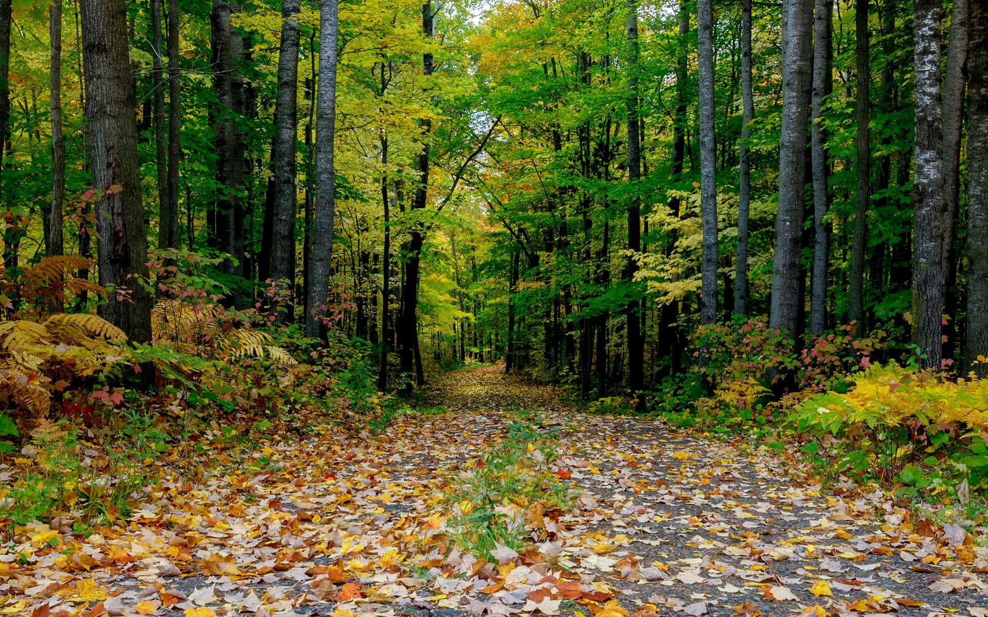
The key context for understanding why this drive looks the way it does: the Driftless Area. The glaciers that flattened most of Wisconsin missed this southwestern corner, leaving behind steep ridges, deep coulee valleys, and bluffs that rise 400 to 600 feet above the river. The terrain is vertical instead of flat, and from the overlooks you’re looking across the Mississippi into Minnesota or Iowa while the river is somewhere far below. The full Great River Road Trip itinerary maps out a two-day version of the drive with overnight stops in La Crosse and Prairie du Chien for anyone who wants a ready-made plan.
The Stops Worth Leaving the Car For
Stockholm, a village of about 66 people on Lake Pepin, has more galleries and food stops per capita than almost anywhere in Wisconsin. The Stockholm Pie and General Store is a real reason to budget 30 minutes here. Lake Pepin itself, the widest naturally occurring lake on the Mississippi, opens up the view before the bluffs close back in south of town. In Pepin, eight miles down the road, Laura Ingalls Wilder was born in 1867. The Little House Wayside cabin replica is seven miles north of town on County Road CC, a small but specific stop for anyone who grew up on the books.
Alma sits roughly midway through the northern section of the route, its main street pressed between a limestone bluff and the river with almost no room for anything else. Lock and Dam No. 4 here is one of the best spots in Wisconsin for watching bald eagles, especially from November through March when they concentrate around the open water below the dam. On a quiet February morning you can spot 30 or 40 eagles in under an hour from the bank below the dam.
Trempealeau sits near two of the route’s best natural stops. Perrot State Park, just south of town, has river bluff trails and some of the best bluff-top views on the route. For notes on how Perrot compares to Wisconsin’s other strong parks, the best Wisconsin state parks guide covers the full list. The Historic Trempealeau Hotel, open in some form since 1871, has a bar, rooms, and a deck over the river backwater. It’s one of the more atmospheric stops on the whole drive.
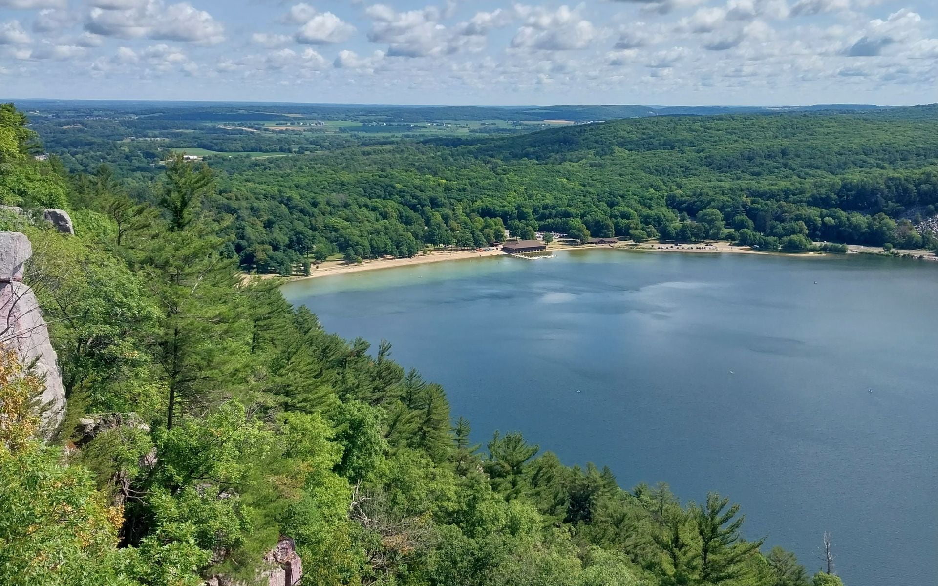
Wyalusing State Park, near Prairie du Chien, is one of the geographic highlights of the entire route. The park sits at the confluence of the Wisconsin and Mississippi rivers, and the Sentinel Ridge and Point Lookout trails put you 500 feet above the meeting point of the two rivers, with sight lines extending miles in both directions. Plan 90 minutes to two hours minimum for the overlook loop. A Wisconsin State Park vehicle sticker is required for entry; a daily pass runs around $8 to $10 (estimate).
Potosi, about 20 miles south of Prairie du Chien, houses the National Brewery Museum inside the original Potosi Brewery building, which dates to 1852 and stretches along the main street for an improbable length. The museum and working brewery are open most of the year. The Dickeyville Grotto, near the route’s southern end, is a folk art installation built from 1925 to 1930 by a local Catholic priest using shells, stones, colored glass, and minerals pressed into concrete to create religious shrines. It’s unusual and worth 20 minutes.
La Crosse: The Best Base on the Route
La Crosse is the largest city on Wisconsin’s Great River Road at around 50,000 people and the logical base for the northern and central sections of the drive. Grandad Bluff, reached by car up Bliss Road from downtown, rises about 600 feet and gives you a panorama of the city, the Mississippi River valley, and on clear days a sweep of three states.
For dinner in La Crosse, Buzzard Billy’s on Pearl Street serves Cajun-influenced comfort food, including crawfish etouffee, fried catfish, and a beer cheese soup that reviewers keep mentioning. The building is a block from the riverfront and has a genuine local following. North Country Steak Buffet on Rose Street is a different proposition: an all-you-can-eat steak buffet with grilled-to-order sirloin that runs around $16 per person (estimate) and fills up with locals most nights. Both are a good dinner stop after a day on WI-35.
The Wisconsin Travel Guide covers all seven of the state’s travel regions, including the Driftless Area and Great River Road, if you’re piecing together a longer trip that goes beyond the bluff country.
When to Drive It
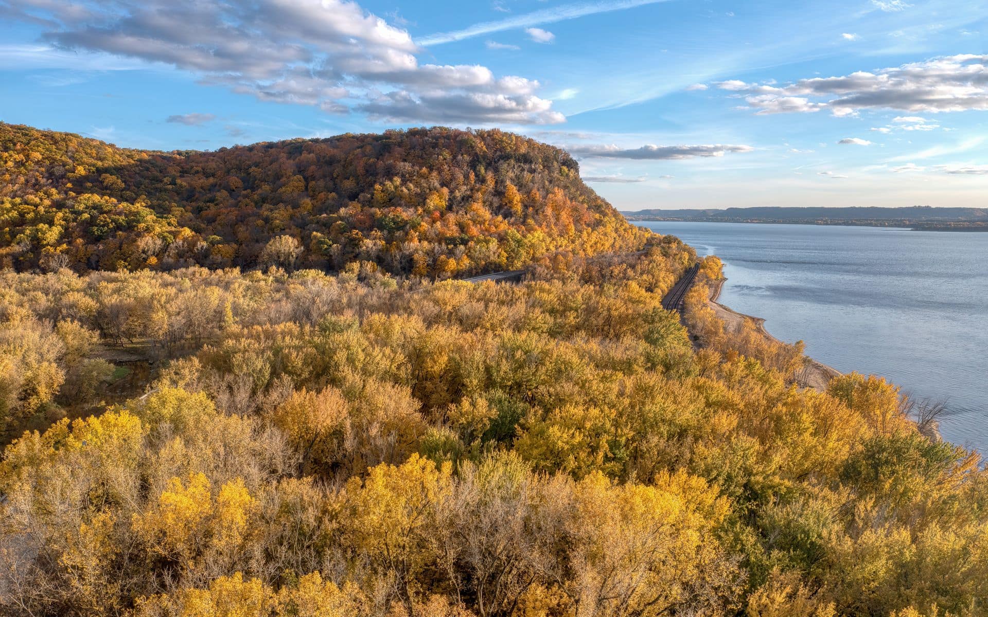
Fall is the reason most people finally make the drive. The hardwood trees on the bluffs, mostly oak, maple, and hickory, turn mid-October in most years, and the color on the ridge tops above the gray-blue river is one of the better fall color experiences in Wisconsin. Peak color on the Mississippi bluffs typically runs October 10 through 25, though it shifts depending on the year. See the Wisconsin travel calendar for specifics and what to expect from each season.
Summer (June through August) opens up the river towns and parks fully. Some of the backwater areas near Trempealeau have sandy beaches accessible by canoe or kayak. Expect humidity and weekend crowds in the state parks July through August. Spring is quiet and good for the coulee trout streams in the Driftless valleys east of WI-35. The coulees hold some of the best spring trout water in Wisconsin, with streams opening in early to mid-April.
Winter is mostly for eagle watchers and people who want to drive the route with next to no traffic. Alma’s Lock and Dam No. 4 is the best single viewing spot from November through March. The bluffs under snow are striking. Prairie du Chien and La Crosse both have year-round hotels and restaurants, so the logistics of a winter visit are straightforward.
Practical Notes Before You Go
La Crosse is the practical entry point for most drivers: about 3.5 to 4 hours from Chicago via I-90 west, about 2.5 to 3 hours from Madison, and about 3 to 3.5 hours from Minneapolis. Prairie du Chien, midway on the southern half, is about 3 hours from Madison and about 2.5 hours from the Twin Cities. The La Crosse Regional Airport (LSE) has connections through Minneapolis, but most visitors drive in.
Highway 35 runs as a two-lane road for most of its length, with minimal passing lanes and a 55-mph speed limit through many of the river towns. Plan for it: this is not a route where you make fast time. The small river towns between La Crosse and Prairie du Chien, including Genoa and De Soto, don’t have gas stations in any meaningful sense. Fill up in La Crosse, Prairie du Chien, or Viroqua (east of the route on US-14) and don’t count on finding fuel in the villages.
For a very different corner of Wisconsin, the Lake Geneva weekend guide covers the resort lake country in the southeast, which sits about three hours from the southern end of the Great River Road and makes for a contrast trip: resort lakes and Gilded Age mansions instead of river bluffs and coulee valleys.
Frequently asked questions
How long does it take to drive the Wisconsin Great River Road?
The full 250-mile route from Prescott to the Iowa border takes roughly four to four and a half hours of pure driving time with no stops. Budget at least two days if you want to explore towns, hike Wyalusing State Park, and spend time at overlooks along the route. Most people base in La Crosse for the northern half and Prairie du Chien for the southern half.
What is the best time of year to drive the Wisconsin Great River Road?
Mid-October for fall color, when the hardwoods on the bluffs turn above the river. Peak color on the Mississippi bluffs typically runs October 10 through 25. Summer is warmer with more open facilities in the parks and river towns. Winter is best for eagle watching near Alma’s Lock and Dam No. 4, where bald eagles concentrate from November through March.
What are the best stops on the Wisconsin Great River Road?
Wyalusing State Park (500-foot overlooks at the confluence of the Wisconsin and Mississippi rivers), Alma (eagle watching at Lock and Dam No. 4), Stockholm (Stockholm Pie and General Store, Lake Pepin views), Perrot State Park near Trempealeau, Grandad Bluff in La Crosse (600-foot panorama of three states), and the National Brewery Museum in Potosi. The Dickeyville Grotto near the southern end of the route is a singular folk art stop.
Is Wyalusing State Park worth stopping at on the Great River Road?
Yes. The confluence of the Wisconsin and Mississippi rivers is one of the most significant geographical features in the state, and the Point Lookout and Sentinel Ridge overlooks put you 500 feet above it with clear views down both rivers. Plan 90 minutes to two hours for the overlook loop trails. A Wisconsin State Park vehicle sticker is required; a daily pass runs around $8 to $10 (estimate).
Where should I stay along the Wisconsin Great River Road?
La Crosse has the widest range of hotels for the northern and central sections of the route. Prairie du Chien has year-round lodging and is well-placed for the southern half, including Wyalusing State Park, Potosi, and Cassville. The Historic Trempealeau Hotel is a genuine option if you want a river-bluff atmosphere rather than a chain property, though book ahead during fall color weekends.