Overview
The Wisconsin segment of the Great River Road runs along the Mississippi from Prescott, just south of the Twin Cities, to the Illinois line near Kieler, about 250 miles total. Most people drive north to south or south to north over 3 to 4 days at a comfortable pace. This itinerary starts at the southern end near Prairie du Chien and works north to Prescott, with the most dramatic bluff country in the middle and La Crosse as the logical base for the second night. The route runs on State Highway 35 for most of its length, but the best views come when you turn off onto county roads that climb the limestone bluffs above the river. Plan on driving slower than your GPS suggests. For more on planning a Wisconsin trip from the ground up, the Wisconsin Travel Guide covers the full state. If you are comparing this drive to other route options, the Wisconsin Dells Family Trip runs through central Wisconsin along the sandstone Wisconsin River gorge for a very different kind of road-trip experience.
Getting here: from Madison (MSN), Prairie du Chien is about 85 miles west on US-18, roughly 1.5 to 2 hours. From Milwaukee (MKE), the drive runs about 3.5 hours via I-90/94 to Madison and then US-18 west. The La Crosse Regional Airport (LSE) has limited commercial service but is useful if you want to fly into the middle of the route and drive one direction from there. Minneapolis-St. Paul (MSP) sits about 2 hours from the northern end at Prescott. A car is essential; this route has no meaningful public transit. The Lakes and Beaches guide covers the Mississippi backwaters paddling and fishing options if you want to plan time on the water rather than in a car.
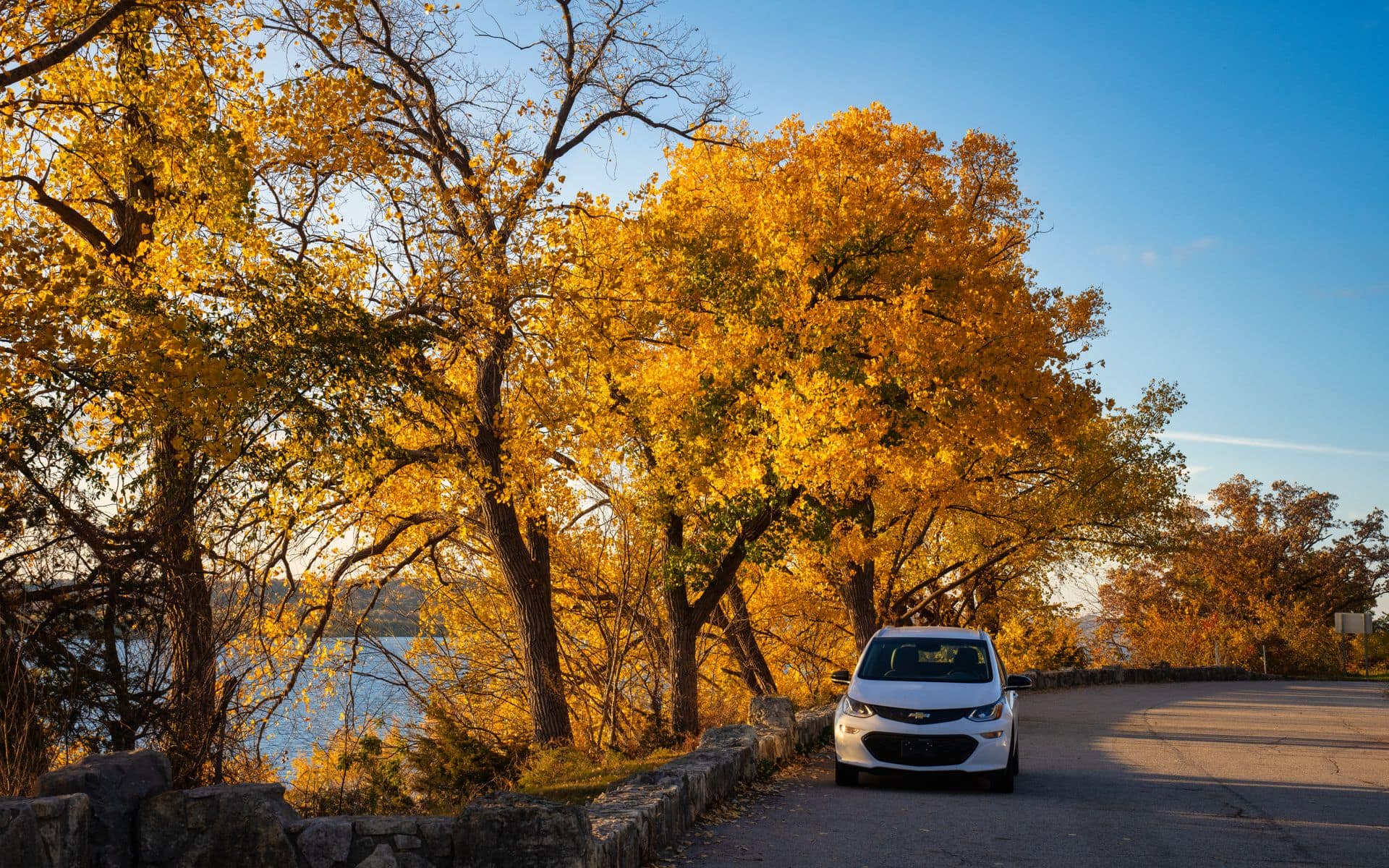
Timing matters on this route. Fall color on the limestone bluffs peaks from late September into mid-October and turns Buffalo County into some of the best leaf country in the state. Summers, June through August, are good for boating the backwaters, birding the wildlife refuges, and the full range of state park activities. December through February is bald eagle season at Alma, where concentrations of 200 or more birds gather at Lock and Dam No. 4 when ice forces fish into the open water below the spillway. Spring, especially late April and May, brings walleye season and blooming river bottomlands. Whatever season you choose, build in at least one county-road detour above the bluff line. The views from 400 to 600 feet above the river are the real payoff of this drive, and you will miss most of them if you stay on WI-35 the whole way.
Day 1: Prairie du Chien and Wyalusing State Park (Approx. 40 Miles)
Prairie du Chien anchors the southern end of this itinerary and is the most logical starting point if you are coming from Madison or Chicago. The town sits at the confluence of the Wisconsin River and the Mississippi and is one of the oldest European settlements in the state. The Fort Crawford Museum on South Beaumont Road covers frontier Wisconsin history, including the genuinely odd chapter about Dr. William Beaumont studying human digestion through a soldier's permanent stomach wound in the 1820s. Admission runs about $8 to $12 per adult (estimated). Give yourself an hour, then head south.
The main event near Prairie du Chien is Wyalusing State Park, about 12 miles south via US-18 and County Road X. The Point Lookout and Sentinel Ridge trails climb to overlooks 500 feet above the confluence of the Wisconsin River and the Mississippi. On a clear October morning, the view from Point Lookout ranks among the best in the state: two rivers joining, islands covered in cottonwoods, and the Iowa bluffs on the far bank. A daily vehicle admission sticker runs about $8 to $13 (estimated), and an annual pass costs about $28 to $33, which is worth it if you plan to stop at Devil's Lake or Peninsula State Park on the same trip. Campsites in the River Ridge area sit above the bluff and book fast on fall weekends; reserve through the Wisconsin DNR system well ahead of your trip.
If time allows after Wyalusing, drive 20 miles south to Cassville. Nelson Dewey State Park sits on a bluff above a river bend and is much less crowded than Wyalusing. The adjacent Stonefield Historic Site re-creates an 1890s Wisconsin farming village with costumed interpreters in summer. Between Wyalusing and the Cassville stop, plan about 4 hours total. Spend the first night in Prairie du Chien or camp at Wyalusing.
Day 2: Trempealeau, La Crosse, and Grandad's Bluff (Approx. 65 Miles)
From Prairie du Chien, WI-35 follows the river north through Genoa and Ferryville toward La Crosse, about 65 miles. The villages along this stretch are small, and most of the drive is a scenic bluff-and-river corridor with few commercial distractions. Trempealeau, about 15 miles south of La Crosse, is worth a stop. Perrot State Park at the north edge of town puts you on Brady's Bluff, a 500-foot climb above the river floodplain with views across to the Minnesota bluffs on the far bank. The hike to the summit runs about 1.5 miles round trip on a moderate grade. The Trempealeau National Wildlife Refuge just west of town is one of the better spots in the state to see sandhill cranes during the September and October migration. Pull off at the impoundment dike road and scan the shallow water; thousands of birds stage here in early fall.
La Crosse is the largest city on the route, with roughly 52,000 residents, and it earns an overnight stop. Drive up to Grandad's Bluff City Park, a free overlook on the city's east side about 600 feet above the river. From the viewing platform, the Mississippi and its braided channels, islands, and the Minnesota bluffs on the far bank spread across the full horizon. This is the single best free view on the Wisconsin portion of the route. Come back down to Riverside Park along the river levee and then walk the few blocks to Pearl Street, the city's main commercial strip, for coffee and dinner options.
For dinner, Buzzard Billy's at 222 Pearl Street serves Cajun-influenced river food with mid-range prices, typically $14 to $22 per entree (estimated), and draws a reliable local crowd. After dinner, The Crow on 3rd Street is La Crosse's well-regarded local brewery, with a comfortable taproom and an approachable tap list that changes with the season. For the night, The Charmant Hotel on Main Street occupies a restored 1890s candy factory and is the best boutique lodging in the city, with Mississippi views from upper-floor rooms. Rates typically run $149 to $249 per night (estimated) in summer and fall, with fall-color weekends at the top of that range.
Day 3: Alma, Lake Pepin, and Prescott (Approx. 90 Miles)
The northern third of the Wisconsin Great River Road, from La Crosse to Prescott, is the most varied stretch. Leave La Crosse on WI-35 north. Alma, about 40 miles and 50 minutes north, sits below Buffalo County's most dramatic bluffs, with limestone walls rising 500 feet directly from the river corridor with almost no valley floor between the water and the ridgeline. The Lock and Dam No. 4 overlook platform on the bluff above town is one of the premier bald eagle watching sites in the lower 48 states. December through February, open water below the dam draws concentrations of 200 or more bald eagles, especially on cold mornings when walleye are most active near the spillway. In warmer months, the overlook gives a clear view of river commerce and the upstream pool called Lake Alma. The overlook is free, takes about 15 minutes, and is one of the genuine insider stops on this route that most visitors cruise past without knowing it exists.
North of Alma, WI-35 passes through Fountain City before reaching Pepin, about 25 miles from Alma. Pepin is the birthplace of Laura Ingalls Wilder, born here in 1867 before her family moved to the South Dakota prairie. A reconstructed log cabin at the Little House Wayside site sits about 7 miles north of town on County Road CC; the Pepin Historical Museum downtown covers the connection in more detail and charges a small admission in summer. Lake Pepin, the natural lake formed by the Chippewa River's delta backing up the Mississippi, is genuinely large here, stretching 22 miles south and 2 miles across. Kayakers, sailboaters, and windsurfers use it regularly from May through October.
Continue north through Stockholm, a single-street village known for galleries and seasonal shops, and Maiden Rock, where a bluff overlook gives one of the last dramatic views before the terrain opens up approaching Hudson. Prescott, about 55 miles from Pepin and the northern terminus of the Wisconsin route, sits at the junction of the St. Croix River and the Mississippi. Freedom Park in Prescott gives a direct view of the brown Mississippi meeting the clearer blue-green St. Croix, and it is a fitting last stop on the drive. Hudson is about 25 minutes north on I-94, and St. Paul is another 30 minutes beyond. If you are looping back to Milwaukee or Chicago, budget 5 to 5.5 hours via I-94 east. For those adding more Wisconsin shoreline to the trip, the Door County & the Bay region covers Lake Michigan's eastern shore and the Door Peninsula as a logical second Wisconsin chapter.
Where to Stay
La Crosse is the practical base for this itinerary. The Charmant Hotel is the best boutique option in the city, and chain hotels cluster around the I-90 interchange on the east side of La Crosse for a more straightforward overnight. Prairie du Chien has a handful of chain motels near the Wisconsin River confluence and a few smaller B&B properties. Primitive and electric camping at Wyalusing and Perrot state parks runs about $20 to $35 per night (estimated). The Nelson Dewey campground at Cassville is small and books fast in fall. All Wisconsin state park campsites are reservable online through the DNR system; fall-color weekends in late September and early October fill months in advance. If you are pairing this route with a Door County trip, the Door County Weekend itinerary notes that those lodging markets tighten fast in July and October as well.
Book These Ahead
Wisconsin state park campsites at Wyalusing in particular go fast for fall-color weekends starting in mid-September. Reserve through the Wisconsin DNR's online reservation system as soon as your dates are set, ideally 6 to 8 weeks out for fall. The Charmant Hotel in La Crosse fills during Oktoberfest, the city's German heritage festival in late September, and on fall-color weekends in October. If the bald eagle watching at Alma is your main draw and you are visiting in December or January, check road conditions before you go: WI-35 in Buffalo County can close briefly after heavy snowfalls, and the bluff overlook parking area is not always plowed quickly. Flying out from this route is easier from MSP in the north or MSN in Madison to the south; the La Crosse LSE airport has limited connections and should be booked well ahead if you plan to use it.
Frequently asked questions
How long is the Wisconsin Great River Road?
The Wisconsin segment of the Great River Road follows State Highway 35 for about 250 miles along the Mississippi, from Prescott in the north to the Illinois border near Kieler in the south. Driving the full route with stops at state parks, bluff overlooks, and river towns takes 3 to 4 days at a comfortable pace. The route passes through Crawford, Vernon, La Crosse, Trempealeau, Buffalo, Pepin, Pierce, and St. Croix counties.
When is the best time to drive the Great River Road in Wisconsin?
Fall color from late September into mid-October is peak season, when the limestone bluff maples turn orange and the river towns fill with leaf peepers. Summer, June through August, is the best window for paddling the backwaters, birding the wildlife refuges, and camping in the state parks. December through February is bald eagle season at Alma, where concentrations of 200 or more birds gather near Lock and Dam No. 4 when ice concentrates fish below the open water. Spring, late April and May, brings walleye season and the first wildflowers on the bluff edges.
Do I need to pre-book anything for this route?
Yes, for the most popular windows. State park campsites at Wyalusing and Perrot fill weeks ahead for fall-color weekends in September and October; reserve through the Wisconsin DNR online system as soon as your dates are set. The Charmant Hotel in La Crosse sells out during Oktoberfest in late September and on fall-color weekends. Outside of those peak windows, the Great River Road is relatively spontaneous-friendly, though lodging inventory in the river towns is limited and even a minor local event can fill the few available rooms quickly.