Wisconsin Hiking Overview
The Wisconsin Travel Guide covers a state shaped by repeated glacial advances, and that geology makes hiking here more interesting than the terrain implies from the highway. The last ice sheet deposited the ridgelines of the Kettle Moraine, exposed the quartzite bluffs at Devil's Lake near Baraboo, and left a landscape of kettles, kames, and glacial lakes across the central and southern regions. The one part the ice skipped is the Driftless Area in the far southwest, where the land took a different form entirely: tight river valleys, steep limestone and sandstone bluffs above the Mississippi, and overlooks at places like Brady's Bluff in Perrot State Park near Trempealeau that drop roughly 540 feet to the river floodplain below.
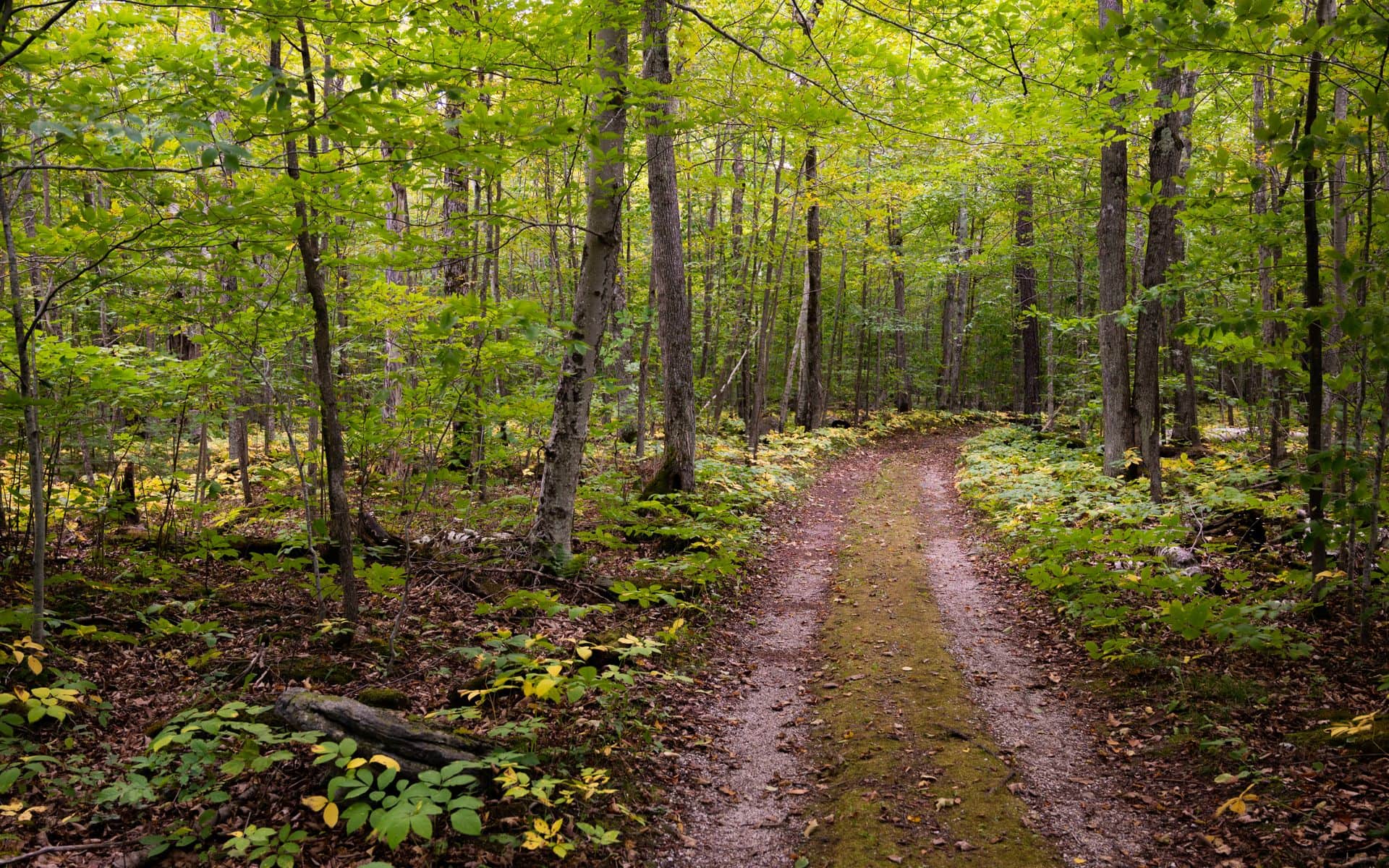
The Ice Age National Scenic Trail is the state's backbone trail, running 1,200 miles from Potawatomi State Park in Sturgeon Bay west to Interstate State Park near St. Croix Falls on the Minnesota border. It is the only National Scenic Trail contained entirely within a single state. The Ice Age Trail Alliance, headquartered in Madison, maintains free downloadable segment maps and sells a printed county-by-county map set for around $10. You don't need to hike the full route to benefit from it. The Scuppernong area in the Kettle Moraine Southern Unit near Eagle, where the Ice Age Trail passes through restored oak savanna and glacial terrain, is one of the better day-hike options in southeastern Wisconsin for anyone wanting marked trail and easy road access from Milwaukee, about 40 miles east on US-12.
Where to Hike in Wisconsin
Devil's Lake State Park near Baraboo is Wisconsin's most-visited park and its most dramatic hiking. A spring-fed lake fills a narrow gap between 500-foot quartzite bluffs, and CCC-era stone stairways built in the 1930s climb each ridgeline to views across the water and the Baraboo Hills. The East Bluff Trail (roughly 4.0 miles round trip from the south shore trailhead) and the Balanced Rock route are the signature hikes, with the full bluff loop covering around 6 miles if you connect both sides. The park is about 45 minutes north of Madison via US-12, or 15 to 20 minutes south of Wisconsin Dells off WI-123. Families staying at Wilderness Resort in the Dells can use it as a base for a Devil's Lake day trip, pairing a morning on the bluffs with an afternoon back at the waterpark. Ten minutes west of Devil's Lake, Parfrey's Glen State Natural Area off County Road DL near Merrimac is Wisconsin's oldest designated state natural area (established 1952) and sees far less traffic than the main park. A narrow, shaded ravine with boardwalk sections leads back into a gorge where columbine blooms along the creek in May, and the geology is close to identical to what you'll see at Devil's Lake without the weekend parking crunch.
Peninsula State Park in Door County covers 3,776 acres of mixed hardwood and conifer forest on the Green Bay shore of the Door Peninsula. The Sentinel Trail (3.7 miles round trip) climbs past rocky limestone outcrops to Eagle Tower, where the views extend across Green Bay to the Garden Peninsula in Michigan on a clear day. The Minnehaha Trail hugs the limestone shoreline near the park's southern edge with water views through the trees. The Door County Weekend itinerary builds in time at Peninsula State Park alongside the fish boil and cherry stops that define a peninsula trip. A short drive south on County Road T from Jacksonport, Cave Point County Park delivers a limestone shelf right at water level where Lake Michigan waves carved sea caves over centuries. There are no maintained trails, but you can walk directly from the free parking area to the shoreline and follow the shelf in either direction.
Up north, Copper Falls State Park near Mellen in Ashland County features a red-brown sandstone gorge through which the Bad River drops in a series of waterfalls, the main drop falling about 30 feet into the canyon below. The 2.4-mile Bad River Loop covers the main falls and the gorge rim and is accessible from the park's main lot off WI-169. The trailhead is about 2.5 hours northeast of Wausau on WI-13 and makes sense as a half-day stop on a longer Northwoods circuit. At the opposite end of the state, Pattison State Park near Superior holds Big Manitou Falls at 165 feet, the tallest waterfall in Wisconsin, on the Black River. It is a 1.6-mile round trip walk from the main parking area off US-35, accessible year-round, and about 20 minutes south of Superior. For hikers based in Sheboygan, Blue Harbor Resort sits about 35 minutes from the Kettle Moraine Northern Unit near Greenbush, where the Zillmer Trail system offers a network of loops ranging from 2.1 to 7.4 miles through classic glacial terrain of kettles and eskers typical of the Northern Unit.
Best Season for Hiking in Wisconsin
June through mid-October covers the practical hiking window. Summer (June through August) brings full foliage cover and green forest across the state, but the most popular parks, particularly Devil's Lake and Peninsula State Park in Door County, see their heaviest crowds on summer weekends. Both parks can fill their parking lots before noon on a July Saturday. Arriving before 9 a.m. or picking a Tuesday through Thursday visit makes a genuine difference. The Northwoods, including trails in the Chequamegon-Nicolet National Forest around Mellen and Cable, sees lighter crowds all summer and is the better call if your priority is solitude over amenity.
Fall is the best season for day hiking in Wisconsin. Late September through mid-October brings fall color across the hardwood ridges of the Baraboo Hills, the Kettle Moraine, and the Door Peninsula, and cooler temperatures make longer trail days more comfortable. Crowds drop sharply after Labor Day, and parking stops being an obstacle at parks that are packed in July. The Northwoods typically sees peak color in the first two weeks of October, while the Baraboo Hills and Door Peninsula usually peak in the second or third week of October, a few days behind. Winter hiking is possible in the southern parks through December and March, though ice on exposed trails like the East Bluff at Devil's Lake makes microspikes worth packing. That winter window overlaps with the skiing and snowshoeing season, and many of the Kettle Moraine trail systems double as groomed cross-country ski routes in good snow years.
Typical Costs
The main cost for Wisconsin hiking is the state park vehicle admission sticker: $10 per day or $36 for an annual sticker valid at all state parks, including Devil's Lake, Peninsula State Park, Copper Falls, Pattison, Governor Dodge, and both units of the Kettle Moraine State Forest. The annual sticker covers itself after four park visits. Ice Age Trail trailheads outside state park boundaries are generally free. Cave Point County Park in Door County charges nothing for entry or parking. Parfrey's Glen State Natural Area near Merrimac uses the standard state park sticker.
Guided hiking tours, offered by a handful of outfitters in Door County and the Bayfield area, run roughly $40 to $90 per person (estimate range) for half-day outings that pair trail time with interpretation of local geology or bird life. Most Wisconsin hiking is self-guided with no cost beyond the park sticker. After a long day on trail near the Baraboo Hills or the Kettle Moraine, many hikers build in a stop at one of the best supper clubs in Wisconsin on the drive back. The pairing of a brandy old fashioned and a Friday fish fry after a full bluff hike is as Wisconsin as it gets.
How to Plan Your Hiking Trip
Wisconsin state parks don't require trail reservations for day-use hiking. Campsite reservations at busy parks, including Devil's Lake, Peninsula State Park, and Copper Falls, fill months ahead for summer weekends and can be made at reserveamerica.com. Vehicle admission stickers are sold at park entrance booths and online through the Wisconsin DNR website. If you plan to visit more than three or four state parks in a season, the $36 annual sticker is the straightforward choice.
For trips into the Chequamegon-Nicolet National Forest, day hiking on national forest trails generally requires no permit. The U.S. Forest Service's Recreation.gov handles some designated camping registrations within the forest. Cell service is limited or absent across most of the Northwoods, so downloading offline maps or printing paper maps before you leave is practical, not optional. The Ice Age Trail Alliance website lists current trail conditions, seasonal closures, and road crossing details by county segment for anyone planning a connected multi-day hike. If you want an urban base with quick access to south-central Wisconsin hiking, The Madison Concourse Hotel in downtown Madison is about 30 minutes from Blue Mound State Park via US-18/151 and sits close to the Military Ridge State Trail, which links Madison to Dodgeville through the rolling southern Driftless edge.
Frequently asked questions
What is the most popular hiking trail in Wisconsin?
The East Bluff Trail at Devil's Lake State Park near Baraboo draws more hikers than any other trail in the state. The route follows the quartzite ridgeline above the lake with CCC-built stone stairways from the 1930s, and the views across the water to the opposite bluff are the best you'll find in southern Wisconsin. The park is about 45 minutes north of Madison via US-12 and 15 to 20 minutes south of Wisconsin Dells on WI-123. Parking fills by mid-morning on summer weekends, so an early start matters.
Do you need a permit to hike in Wisconsin state parks?
No trail permit is required for day hiking in Wisconsin state parks. You do need a vehicle admission sticker to park at any state park trailhead: $10 for a daily sticker or $36 for an annual sticker valid at all Wisconsin state parks. Stickers are sold at park entrance booths or online through the Wisconsin DNR. Camping requires a site reservation, but day-use trail access does not.
What is the Ice Age Trail in Wisconsin?
The Ice Age National Scenic Trail is a 1,200-mile footpath that follows the terminal moraine left by the last glacial advance, running across Wisconsin from Potawatomi State Park in Sturgeon Bay east to Interstate State Park near St. Croix Falls on the Minnesota border. It is the only National Scenic Trail contained entirely within one state. The Ice Age Trail Alliance in Madison maintains the trail and provides free downloadable segment maps on its website. Most hikers tackle individual county segments as day hikes rather than attempting the full route.
When is the best time to hike in Wisconsin for fall colors?
Late September through mid-October is the window. The Northwoods, including trails around Copper Falls State Park near Mellen, Cable, and the Chequamegon-Nicolet National Forest, typically peaks in the first two weeks of October. The Baraboo Hills around Devil's Lake and the Kettle Moraine usually peak in the second or third week of October, a few days behind the north. The Driftless bluffs near Perrot State Park in Trempealeau and Wyalusing State Park above Prairie du Chien run close to the same timing as the Baraboo area. Crowds thin considerably after Labor Day, making the fall shoulder period the practical sweet spot for anyone who wants color without July-level competition for parking.