How We Picked
We focused on routes where fall color comes at road level and through the windshield, not just from a single overlook. We weighted toward highways lined with sugar maples, which turn orange and red, rather than corridors dominated by aspens and birches alone, which go yellow. Each drive on this list has at least one town or park along the way worth stopping in. Drive times are one-way unless noted, and peak color windows are based on historical averages.
We also considered practicality: road quality, whether lodging is available nearby, and whether the route works as a day trip from a major base like Madison, Milwaukee, or Green Bay. Check the Wisconsin DNR fall color report before you leave; the season can shift by a full week depending on summer heat and rainfall, and the weekly updates are reliable.
1. Highway 42 Through Door County
The bayside route up the Door Peninsula runs about 60 miles from Sturgeon Bay through Egg Harbor, Fish Creek, Ephraim, and Sister Bay to Gills Rock at the northern tip. Highway 42 through this stretch is lined with sugar maples that go orange and red in early-to-mid October, typically around the first or second weekend of the month. The color reads well from the road, but the bluff trails inside Peninsula State Park put you inside the canopy and above it at the same time. The Eagle Trail on the east bluff is 2.3 miles and looks out over Eagle Harbor and the village of Ephraim below.
The small villages along Door County's bayside are worth the stops. Fish Creek has galleries and the White Gull Inn for lunch. Sister Bay has Al Johnson's Swedish Restaurant and the now-famous goats on the sod roof. On the return, take Highway 57 down the lake side through Baileys Harbor and past Cave Point County Park, where the flat rock shelves along Lake Michigan frame the color well. Round-trip from Sturgeon Bay is about 2.5 hours of driving, more with stops. Book lodging early because October weekends on the peninsula sell out weeks in advance.
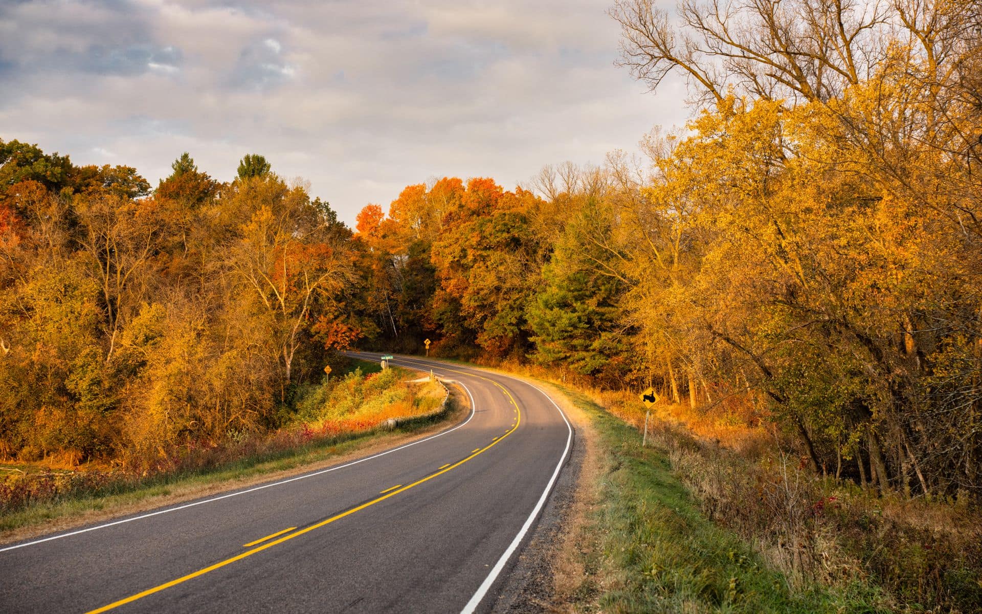
2. Great River Road: La Crosse to Prairie du Chien on Highway 35
Highway 35 follows the Mississippi River bluffs for 107 miles from La Crosse south to Prairie du Chien, making it one of the most consistent fall color corridors in the state. The bluffs rise 400 to 500 feet above the river, and the maple-oak mix on those slopes turns together in mid-October. Views open across the river to the Iowa and Minnesota bluffs, which are coloring at the same time. The best pull-offs are above Genoa, at the overlook near De Soto, and along the ridge road above Ferryville.
La Crosse makes a good base for this drive. It is about 3 hours from Milwaukee or 3.5 hours from Madison. The drive itself takes 2 to 2.5 hours one-way at a reasonable pace, or a full day if you stop in every river town. Extend north of La Crosse toward Trempealeau and Alma if you have two days. Peak color is the second and third week of October; some years it runs a few days earlier.
3. Bayfield Peninsula Loop on Highway 13
Highway 13 circles the Bayfield Peninsula along Lake Superior, running from Ashland through Washburn, Bayfield, and down through the Red Cliff reservation lands before looping back inland. The loop is about 80 miles and delivers color earlier than anywhere else in the state, typically the last week of September or first days of October. The mix here is mostly birch, aspen, and maple, with the gray-blue surface of Lake Superior showing through the trees as the road crests the ridge above Bayfield.
Bayfield's hillside apple orchards are in full harvest during this window. Hauser's Superior View Farm and other orchards along Highway 13 sell apples and cider at roadside stands. The Bayfield Apple Festival runs on the first full weekend of October and draws big crowds to the small harbor town, so if you want the color without the traffic, aim for the week before or the week after. From Duluth, Minnesota, this loop is about 90 minutes each way. From Madison, count on a 5-hour drive to Bayfield, making it a better overnight than a day trip.
4. Kettle Moraine Scenic Drive
The Kettle Moraine Scenic Drive is a 115-mile state-designated route running through Waukesha, Washington, Fond du Lac, and Sheboygan counties in southeast Wisconsin. It follows the glacial landscape shaped by the last Ice Age, using Highway 67 and a series of county roads through Palmyra, Eagle, La Grange, and Greenbush. The northern and southern units of Kettle Moraine State Forest anchor the drive, and the color here is a mix of oaks, maples, and birches against rolling hills and glacial kettle lakes.
Peak color on the Kettle Moraine runs in mid-October, about a week behind the Northwoods. The southern unit near Eagle and Palmyra offers some of the most varied terrain on the route. Lapham Peak inside the southern unit has a 1.5-mile loop to the observation tower at 1,233 feet, the highest point in Waukesha County. The drive is about 2.5 hours one-way without stops and works as a day loop from Milwaukee, which is roughly 40 minutes east of the southern trailhead at Palmyra. A daily vehicle sticker ($8) is required inside the state forest units.
5. Kickapoo Valley: Ontario to Viroqua on Highway 131
Highway 131 drops into the Kickapoo River valley south of Ontario and follows the river through La Farge into the coulee country south of Viroqua. The Kickapoo is a tight, winding river, and the valley walls rise steeply on both sides. In mid-October, the maple and oak mix on those narrow slopes turns red and orange in a way that looks different from any other drive in the state. The late-afternoon light in the valley, when it comes through low and raking from the west, is worth timing your drive around.
The Kickapoo Valley Reserve between La Farge and Ontario protects about 8,600 acres of the watershed and has canoe launches if you want to see the color from the water. Driving time from La Farge to Ontario on Highway 131 is about 30 minutes, but plan for two hours if you want to take the side roads peeling off into the hollow coulees. Viroqua, about 15 minutes south of La Farge on Highway 14, has good food options for a lunch stop, including the Driftless Cafe on Main Street.
6. Northwoods Loop: Minocqua to Eagle River on Highways 51 and 70
Take Highway 51 north from Wausau to Minocqua, then pick up Highway 70 east to Eagle River, then Highway 17 south back to US-51. This loop covers about 160 miles of north-central Wisconsin and hits the Northwoods at its most characteristic: birch stands reflected in lake surfaces, tamarack bogs going gold, and aspen groves running bright yellow along the roadsides. Peak color in the Northwoods comes early, usually the first or second week of October, a week to ten days ahead of central and southern Wisconsin.
Minocqua is the most useful base town on this loop. It has lodging from basic lakeside cabins to the Pointe Hotel on Minocqua Lake. Bosacki's Boat House has been serving fish dinners on the water since 1944 and is worth a stop. If you want to add hiking, the McNaughton Lake Loop and the Pine Lake Trail near Boulder Junction are easy 3 to 4 mile circuits through birch-maple forest. Drive time for the full loop from Minocqua is about 2 hours without stops.
7. Baraboo Hills and Devil's Lake
The Baraboo Hills in Sauk County are an ancient quartzite range that was never submerged by the last glaciation, and the forest cover is old and varied. Highway 113 south of Baraboo and the back roads through the Baraboo Hills State Natural Area run through maple-oak-hickory forest that turns together in mid-October. The hills top out around 1,200 feet, but the ridgeline views open across the Baraboo River valley and toward the Wisconsin River lowlands to the south.
Devil's Lake State Park is the centerpiece of this drive. A vehicle sticker is required ($8 daily, $28 annually for Wisconsin residents). The East Bluff Trail and Balanced Rock Trail on the west bluff both lift you above the canopy for views down to the spring-fed lake below. It is one of Wisconsin's most-visited state parks, and for fall color it earns that status. From Madison, the drive to Devil's Lake is about 55 minutes on US-12. Combine the bluff hike with a loop through the Baraboo Hills on Highway E and County Road DL for a solid half-day circuit.
8. Wisconsin River Valley: Spring Green to Lone Rock on Highways 14 and 60
The Wisconsin River south of the Dells flows through a wide valley floor with river-bottom hardwoods that turn late, usually the third or fourth week of October. Highway 60 from Spring Green west through Lone Rock and on toward Boscobel follows the valley along the south bluff line. The Frank Lloyd Wright Visitor Center at Taliesin in Spring Green is a good anchor for the start of the drive; tours run through October and the grounds are designed to work with the natural slope and tree cover.
The color on this stretch tends to be warmer and later than the northern drives, dominated by cottonwood and silver maple along the river banks and oaks up the bluffs. It runs about 45 miles from Spring Green to Boscobel and takes 1.5 to 2 hours at a casual pace. From Madison, Spring Green is about 40 minutes west on Highway 14, making this an easy afternoon drive in the back half of October when the rest of the state has already peaked.
Quick Comparison
If you have one day and one drive to pick, the Great River Road south from La Crosse on Highway 35 delivers the most dramatic terrain with the most reliable color. For something closer to Milwaukee or Madison, the Kettle Moraine Scenic Drive is the most practical half-day loop. Door County is the most popular fall destination in the state, and for good reason, but book lodging well ahead because October weekends sell out fast. The Northwoods and Bayfield Peninsula give you the earliest color in the state; aim for late September to early October if you want to catch those. The Kickapoo Valley and Baraboo Hills tend to run a week or two behind, giving you a second chance at peak if you miss the first wave. After any of these drives, the supper clubs scattered across the Driftless, Northwoods, and Door County are running their Friday fish fry through October, which makes fall drives a natural fit for a long dinner at the end of the day.
For overnight stays along any of these routes, the Wisconsin hotels and resorts directory covers options from Door County inns and Northwoods lakeside cabins to the Bayfield hill towns and the resort properties in the Dells. Book well ahead for any early-to-mid October weekend anywhere in the state; that window goes fast.
Frequently asked questions
When does fall color peak in Wisconsin?
Peak color varies by region. The Northwoods around Minocqua and Eagle River and the Bayfield Peninsula on Lake Superior typically peak in the last week of September or the first week of October. Central Wisconsin, Door County, and the Baraboo Hills usually peak around the second full weekend of October. The Driftless Area coulees and the Wisconsin River valley tend to run a bit later, peaking in the third or fourth week of October. Southern counties near Madison can hold some color into early November in warm years. Check the Wisconsin DNR fall color report, which updates weekly starting in mid-September.
Do I need a state park vehicle sticker for any of these drives?
Only if you pull into a Wisconsin state park or state forest unit. Devil's Lake State Park, Peninsula State Park in Door County, and the Kettle Moraine State Forest units all require a vehicle sticker. Rates are $8 per day or $28 per year for Wisconsin residents; out-of-state vehicles pay slightly more. You do not need a sticker to drive the scenic highways themselves. If you plan to stop at multiple parks in one trip, the annual sticker pays for itself quickly.
What is the best fall color drive for a day trip from Milwaukee?
The Kettle Moraine Scenic Drive is the most practical option, with the southern unit near Eagle and Palmyra about 40 minutes from downtown Milwaukee. You can complete a 4 to 5 hour loop through most of the 115-mile route and be back in the city by dinner. If you want a slightly longer day, the Baraboo Hills and Devil's Lake loop is about 1.5 hours from Milwaukee and pairs the fall drive with a short bluff hike.
What is the best fall color drive for a day trip from Madison?
The Baraboo Hills and Devil's Lake loop is about 55 minutes from Madison on US-12 and gives you a solid afternoon of color with a bluff hike built in. For a longer day, the Kickapoo Valley route via Highway 14 west and Highway 131 through the coulee country is about 2 hours from Madison but ranks as one of the most scenically distinct drives in the state, especially in mid-October when the steep valley walls are at peak.
Are these fall color drives suitable for RVs or large vehicles?
The main state highways on this list (Highways 42, 35, 51, 131, and 13) are all paved and suitable for RVs and large vehicles. The side roads through the Baraboo Hills on County Road DL and some of the back roads in the Driftless coulee country can be narrow with tight turns; check your route before taking a large rig on those. Peninsula State Park in Door County and Devil's Lake State Park both have RV camping with hookups, though those sites fill quickly in October and require reservations well in advance.