Why Visit Lake Superior & Bayfield
Lake Superior is the largest freshwater lake in the world by surface area, and Wisconsin holds a narrow but dramatic edge of it. The water stays cold through summer, reaching only about 50 to 55 degrees Fahrenheit even in late July, which keeps commercial development light and the shoreline raw in a way you don't find anywhere else in the state. The Bayfield Peninsula curves north into the lake, ringed by WI-13, a state scenic byway that loops through orchard country and tiny fishing communities before arriving at Bayfield's compact harbor.
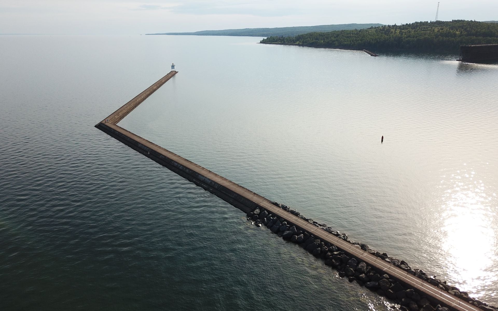
The Apostle Islands National Lakeshore is the organizing fact of this region. All 21 islands and 12 miles of mainland shoreline fall under NPS protection, which means no resort hotels on the islands, no motorboat launches, and no commercial noise beyond the licensed tour operators working out of Bayfield. The lakeshore also holds the largest collection of historic lighthouses in the National Park System: nine of the remaining structures date from the 1850s through the 1890s, and several are still active aids to navigation.
For travelers building a longer Wisconsin trip, this region is the farthest reach of the state, both geographically and experientially. The Wisconsin Travel Guide covers all seven regions; Lake Superior and Bayfield pairs most naturally with the Northwoods of Minocqua and Eagle River if you're coming from the south on a multi-day circuit.
Top Places in the Region
Bayfield is the anchor town and the practical base for everything on the water. Its population sits around 500 people, but the harbor area punches well above that in summer. The National Lakeshore visitor center at 415 Washington Avenue is the right first stop: rangers post current conditions for the sea caves, island trails, and ferry schedules. The Madeline Island Ferry leaves from the foot of Washington Avenue, and most of the kayak outfitters and shops are within two walkable blocks of the dock.
Madeline Island is the only one of the 22 Apostle Islands not protected under the national lakeshore, which means it has roads, a nine-hole golf course, and a year-round village at La Pointe. Big Bay State Park on the island's north end has a beach, a lagoon, and a boardwalk trail worth spending an afternoon on. The ferry crossing from Bayfield takes about 20 minutes. In winters when Chequamegon Bay freezes solid, the ferry stops and the Madeline Island Ferry Line operates an ice road across the strait instead, one of the few places in the Lower 48 where you can drive a car across a Great Lake.
The mainland sea caves at Meyers Beach are the most accessible feature for visitors who stay on land. The trailhead sits about 14 miles west of Bayfield on WI-13 near the fishing community of Cornucopia. A 1.9-mile bluff-top path leads to overlooks directly above the cave openings, and kayak tours launch from the beach below. In the rare winters when the bay freezes thick enough, the NPS opens a walking-ice route from Meyers Beach to the cave entrances, drawing thousands of visitors in a matter of weeks.
Top Things to Do
Kayaking the sandstone sea caves is what most people come here for, and you don't need prior paddling experience to do it. Trek & Trail, based at 7 Washington Avenue in Bayfield, runs guided half-day sea cave tours for beginners through experienced paddlers, with estimates running $75 to $95 per person depending on tour length. Apostle Islands Sea Kayaking - Lost Creek Adventures, located along WI-13 in Cornucopia near the Meyers Beach launch, offers comparable guided trips with a consistent track record for small group sizes and attentive instruction. Apostle Islands Rustic Makwa Den, at 117 South 1st Street in Bayfield, also runs guided kayak tours with an emphasis on the shipwrecks and cave formations visible from the water. All three operators monitor Lake Superior conditions each morning and will reschedule your tour if waves are too high. The lake can develop four- to six-foot swells with very little warning, so build schedule flexibility into your plans.
For a drier option, Apostle Islands Cruises boards at 2 Front Street in Bayfield and runs a narrated Grand Tour that circles multiple islands and passes the sea caves from the water (estimate $40 to $50 per adult). The company also runs a dedicated sea cave boat tour and a sunset cruise. It's the right call for families with young children, anyone who isn't comfortable on a kayak, or visitors who want to see the outer islands and lighthouses that kayak tours don't reach.
Big Top Chautauqua, a blue-and-white canvas performance tent in the hills south of Bayfield off US-2 on Big Top Drive, has hosted concerts and original Wisconsin stage productions every summer since 1986. The season runs June through Labor Day weekend. Beyond national touring acts in folk, blues, and Americana, the venue stages locally written musicals about Wisconsin figures and stories, including past productions on Harry Houdini and Gaylord Nelson. A show night at Big Top fills every restaurant and inn in town, so plan dinner reservations or bring your own picnic.
Apple season is the other reason to make the drive up. The hillside orchards east and south of Bayfield ripen from mid-September through mid-October, and the Bayfield Apple Festival on the first full weekend of October is the busiest event in the region, drawing cider pressing, orchard tours, baked goods, and large weekend crowds. Reserve lodging for Apple Festival weekend by early to mid-July.
Where to Stay
Bayfield has a concentrated mix of Victorian-era inns, bed-and-breakfasts, and vacation rentals within short walking distance of the ferry dock and outfitters. Rooms book out weeks ahead for the height of summer, and Apple Festival weekend in early October is the hardest reservation in the region. The Where to Stay in Wisconsin guide covers current options across all price ranges for the Lake Superior area, including properties in the surrounding towns.
Washburn, 8 miles south on WI-13, and Ashland, 22 miles south on US-2, both offer motel-style lodging at lower nightly rates than Bayfield proper. Either works as a base in shoulder season or if you're traveling on a tighter budget. Staying on Madeline Island at La Pointe is a third option that trades walking distance to the outfitters for proximity to Big Bay State Park. A car is required wherever you stay.
The supper club tradition that defines dinner in most of Wisconsin thins out in this far corner of the state, but a Friday fish fry remains easy to find in Ashland and Washburn. For a broader look at the Wisconsin supper club tradition and where to find the best Friday fish fry by region, the Best Supper Clubs in Wisconsin guide has verified picks.
Getting There and Around
Bayfield is a serious drive from most Wisconsin starting points. From Madison, expect about 4.5 to 5 hours north, approximately 325 miles on US-53 to US-2 to WI-13. From Milwaukee, the trip adds another 30 to 45 minutes, putting it at roughly 5 to 5.5 hours. From Minneapolis, the distance is shorter in your favor: about 2.5 to 3 hours east on I-35 to US-2, crossing into Wisconsin at Superior.
The nearest airport is Duluth International (DLH) in Minnesota, about 45 minutes west of Bayfield on US-2. It's a small regional airport with connections through Minneapolis-St. Paul (MSP), but it saves a substantial drive compared to flying into Milwaukee Mitchell International (MKE) or Madison Dane County Regional (MSN). Rhinelander-Oneida County Airport (RHI) is the closest Wisconsin airport, roughly 2 hours southeast of Bayfield.
A car is required. WI-13, the Bayfield Peninsula Scenic Byway, is the main road and loops the full peninsula past orchard stands, viewpoints, beach access roads, and the Meyers Beach trailhead. There is no public transit to or within the region, and most attractions are spread across 15 to 25 miles of two-lane road. If you're camping on the islands, Apostle Islands Cruises and water taxis serve several island campsites, but a separate boat reservation is needed.
Best Time to Visit
June through August is the main window. Kayak tours and island cruises run on full summer schedules, Big Top Chautauqua is open, and the air temperature stays in the high 60s to low 80s Fahrenheit for most of the season. The lake itself does not warm up enough for comfortable swimming without a wetsuit, but hiking and island exploration are excellent. July and early August are peak crowds; book lodging at least six to eight weeks ahead for weekends.
September and early October are the argument for visiting in shoulder season. Summer crowds drop sharply after Labor Day, fall color arrives in the Bayfield hills in late September and runs through mid-October, the apple orchards are in full harvest, and the weather holds well into October most years. The Apple Festival weekend is a notable exception to the quieter crowds: that first full weekend of October is as busy as peak summer. The week after the festival is typically the best combination of color, open lodging, and reasonable prices.
Winter visits are for a specific type of traveler. The Apostle Islands ice caves at Meyers Beach only become accessible when Chequamegon Bay freezes solid enough for foot traffic, which requires sustained subzero temperatures and typically happens in late January or February, but not every year. The NPS posts condition updates on the Apostle Islands National Lakeshore website and opens access only when ice thickness is confirmed safe. When they do open, the caves draw large daily crowds in a short window. Winter driving on WI-13 and US-2 requires proper tires and respect for lake-effect snow and ice. Some Bayfield inns and restaurants close from Thanksgiving through mid-May, so call ahead before planning a winter trip.
Frequently asked questions
Are the Apostle Islands ice caves open to visit?
The mainland ice caves at Meyers Beach only become walkable when Chequamegon Bay freezes solid enough to support foot traffic, usually requiring sustained temperatures well below zero Fahrenheit for several weeks. This happens in some winters but not every year. The NPS monitors ice thickness and posts live condition updates on the Apostle Islands National Lakeshore website before opening any public access. Don't plan a trip specifically around the ice caves without checking NPS conditions first. When they do open, they can close again within days if temperatures rise.
Do I need kayaking experience to tour the sea caves?
No prior experience is required for a guided half-day tour. Outfitters like Trek & Trail and Lost Creek Adventures include a safety and paddling briefing before every trip, and guides stay with the group throughout. What matters more than experience is the day's conditions: Lake Superior can become too rough for safe cave kayaking even in summer, and reputable operators will reschedule your trip if wave heights are too high. Book your tour as early in your trip as possible to allow time for a weather reschedule.
How far is Bayfield from Madison and Milwaukee?
From Madison, Bayfield is about 4.5 to 5 hours north, roughly 325 miles via US-53 and WI-13. From Milwaukee, add 30 to 45 minutes for a trip of about 5 to 5.5 hours total. Coming from Minneapolis, the drive is shorter: approximately 2.5 to 3 hours east on I-35 to US-2. Duluth International Airport (DLH) in Minnesota is only about 45 minutes from Bayfield and is often the most practical flying option.
Can you visit the Apostle Islands without kayaking?
Yes. Apostle Islands Cruises runs narrated boat tours from Bayfield that take in multiple islands and get close to the mainland sea caves without any paddling required. The Grand Tour covers a large portion of the archipelago over about three hours, and the company also operates a dedicated sea cave boat tour. For the mainland caves at Meyers Beach, the 1.9-mile bluff-top trail provides direct views down into the cave formations without getting on the water at all.